Amazon Workspaces Applications (AppStream 2.0) for WA State Pandemic Centre
By Mafkereseb Bekele and Steve Kinsman
9th November 2020
A State Of Emergency was declared in Western Australia on the 15th of March 2020 in response to the global COVID-19 pandemic.
As a critical Public Health emergency, a fast response was required to address the issues and the potential endangerment of human life as well as be able to quickly deploy and implement the digital systems required to aid in this response.
The Western Australia - State Emergency Coordinator’s Directorate (WA-SECD) needed a secure and performant collaborative spatial platform for collaboration activities around the response to this emergency.
Akkodis, with a deep understanding of geospatial systems and cloud capabilities, responded with a solution environment created in April 2020 for the State Pandemic Centre (SPC) under their direction.
The Scenario
The collaborative spatial platform supports multi-agency data manipulation and analytic activities for the State Pandemic Centre taskforce.
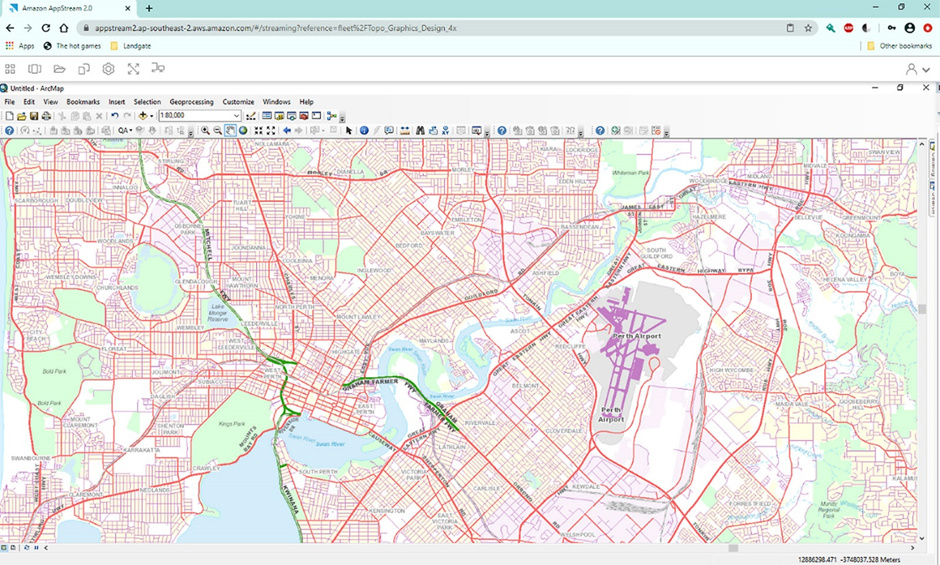
It is based on secure, highly available and scalable cloud services hosted by Amazon Web Services (AWS) in Australia. At a high level, the platform provides virtual desktop applications including ESRI ArcGIS and FME, streamed to users’ desktops via Amazon AWorkspaces Applications (AppStream 2.0). It also includes a shared filesystem for users with the ability to import data to and export data from the shared file system, as well as the ability to publish data to ESRI ArcGIS Online.
The Solution
The solution required the capability to provide secure and scalable spatial platform to run ESRI ArcGIS Desktop, FME, Windows tools and custom scripts without worrying about the management of underlying hardware infrastructure. Amazon AppStream 2.0 was selected as a platform for the configuration and deployment and streaming of the application to end users.

The solution shown in the example image above relies on:
- AWS Managed Active Directory and MFA enabled Single-Sign-On to grant access to streaming sessions
- Domain-joined AppStream 2.0 image builder to install and configure spatial applications and configure windows environment
- A custom AppStream 2.0 image with all the required applications and their configuration
- A scalable AppStream 2.0 fleet to stream virtual applications and sessions to users
- Amazon FSx for a shared file system
- ArcGIS Pro for publishing maps to ArcGIS Online
- ArcMap and FME for spatial data manipulation and spatial analysis
- Script to import and export files to S3
- AutoScaled EC2 used ad DataSync server and to host ArcGIS License and FME License
- VPC in a billing account to host AWS Managed AD and SSO
- VPC in a child account to host AppStream 2.0, EC2s and FSx
- Route53 Resolver to redirect network between to VPCs for resource sharing
- S3 to store installation files to be used for AppStream 2.0 image preparation, home folder for streaming fleets, and enable import and export of files
- CloudFormation to template create network stack, FME License server, and ArcGIS License server
- Default CloudWatch Logs to monitor AppStream 2.0 sessions
The solution was mostly automated except some parts that needed specific manual configuration. The automation was done using AutoScale and Cloud Formation for the network stack, DataSync server, and license server creation.
PowerShell scripts were used to configure AppStream 2.0 image preparation and the manual process to configure the AppStream 2.0 streaming fleet. Python scripts were also used to automate import and export of files to/from shared file server and S3.
The Outcome
The solution enables the State Pandemic Centre taskforce to stream a virtualised application from a highly scalable and secure environment to their desktop over an internet browser or the AppStream 2.0 client. The solution has offered the taskforce the capability to collaborate on multiple tasks, perform spatial analysis, and publish/disseminate maps.
The use of ESRI ArcGIS Desktop and FME in Amazon AppStream 2.0 has enabled the realisation of a flexible and scalable collaborative spatial platform.
The cost effective design of the Akkodis solution gives the ability to hibernate the environment when the Public Health emergency is under control, only paying data storage costs and yet still be able to quickly scale up and restore the environment to full operation when the situation arises.
Akkodis continues to maintain the WA-SECD spatial platform.